
Norfolk County Previous Residents by Era
A Norfolk County address trail changes shape with the period. Recorded land provides the strongest countywide sequence for transfers, but it identifies parties to an instrument rather than every person who lived there. Directories, census material, newspapers, maps, and local files add household or building context. Begin with the source that matches the time period, then use its labels exactly: owner, grantee, occupant, household member, or applicant.
| Record path | Years represented | Where held | What it can establish |
|---|---|---|---|
| Registry recorded land | 1793 to present | Norfolk County Registry of Deeds | Instruments, parties, sequence, legal descriptions, book and page references. |
| Land Court records | 1900 to present | Registry Land Court route | Registered title, certificates, owners, and encumbrance records. |
| Dedham Museum county census collection | 1790 to 1930 | Dedham Museum collections | Household, person, and place snapshots. |
| Federal census | 1790 to 1940 public records | Federal and library research channels | Household structure, age, birthplace, and geography that varies by census. |
| City and town directories | 1870s to 2000s, selected runs | State Library and local repositories | Resident or business presence, street, and historical continuity clues. |
For a recent Norfolk County transfer, start with a municipal assessor's current parcel snapshot and the Registry. For an older address, move quickly to names, legal descriptions, plan references, street sections, and historic place labels. Dedham Museum's house-history files are strongest for Dedham, not a countywide substitute. Municipal permits and assessor cards can add a date or building clue, but no single countywide permit inventory or portal was verified.
Norfolk County Previous Residents and Deeds
The Norfolk County Registry of Deeds holds recorded land instruments from 1793 through the previous day and separates recorded land from Land Court property. Its computerized research environment combines grantor and grantee controls and can be narrowed by party role, document type, town, and date. Older paper logic still helps: find a buyer in the grantee index, inspect the instrument, then use the seller as a new name for the preceding transfer.
The Registry Land Court and registered-land index is the source represented in this image.
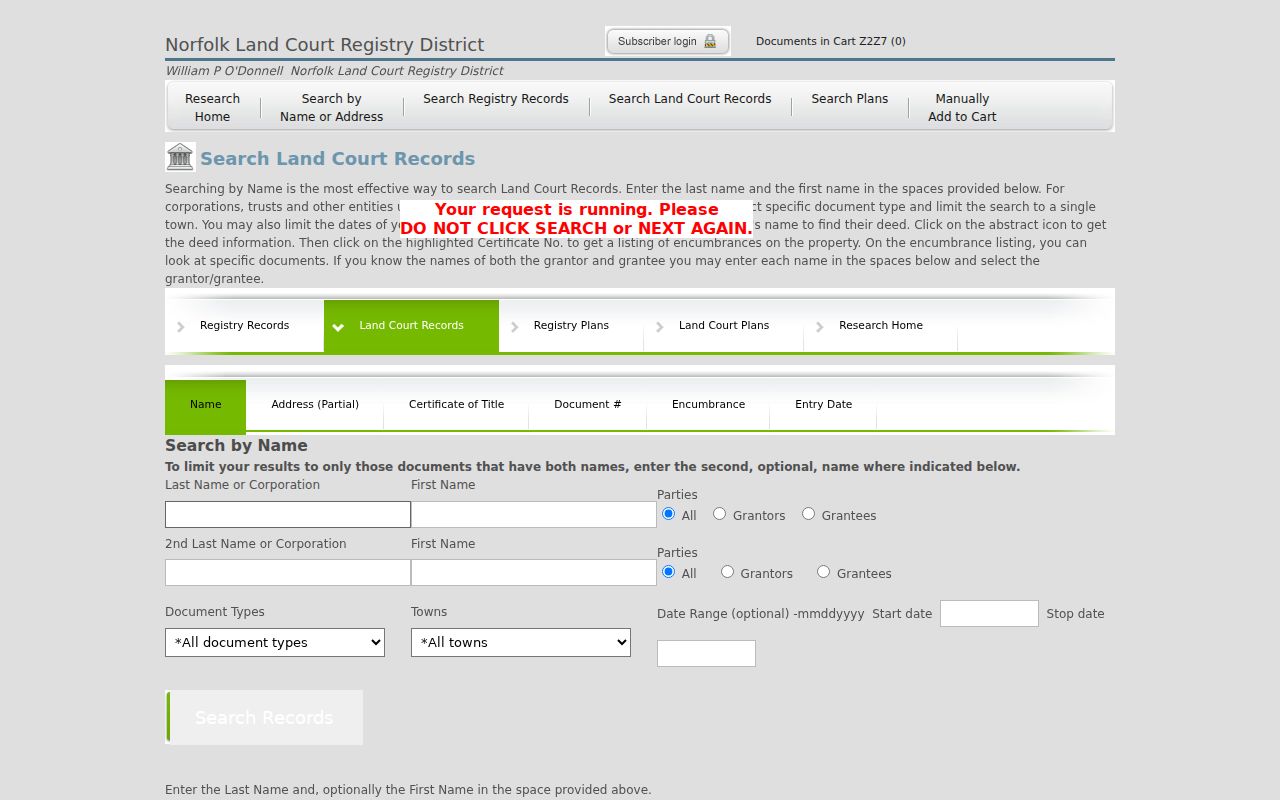
Within Norfolk County, registered land is not a synonym for recent land. It is a separate title system, so a recorded-land search that seems complete can still need a Land Court check. When an instrument is located, retain the book or certificate reference, document type, recording date, party roles, legal description, plan reference, and cited prior instrument. An online image is marked as not an official copy by the Registry.
Tracing Norfolk County Deed Records
In Norfolk County, start with the modern parcel only as a route into the record sequence. Each of the 28 municipalities maintains its own assessment data, so obtain the source municipality from the Registry assessor directory and distinguish the physical situs from the tax-bill mailing address. The owner field is a tax-administration snapshot. The Registry index is a recording history. Both need a date and source note before they can be compared.
- Normalize the current street number, street name, municipality, postal city, ZIP, and any known former street spelling.
- Record the municipal assessor's parcel or map-lot label, current owner name as printed, and the situs and mailing-address labels separately.
- Search the current owner as grantee in the Registry, narrowing by town, document type, and date when needed.
- Open the resulting instrument and retain its grantor, grantee, dates, book or page, legal description, plan reference, and prior-reference field.
- Search the seller as a prior grantee, then repeat the sequence. Switch to Land Court records or plan searching if the trail changes systems or the address disappears.
- Grantor and grantee
- The grantor transfers an interest in an instrument; the grantee receives it. Their roles apply to that document, not to every period of residence.
- Chain of title
- A linked sequence of recorded transfers or title records for a parcel. It is tested instrument by instrument, not assumed from a name match.
- Legal description
- The parcel description in a deed or certificate, often using lots, plans, boundaries, or adjoining owners. It can survive when a street address changes.
- Plan reference
- A cited survey or subdivision plan that can connect a lot, street layout, right-of-way, or earlier property description.
Norfolk County Address Searches Before 2003
The Norfolk County Registry's address field is strongest for modern applicable documents and is very limited before 2003. That limit affects address-first searching, not the underlying land-record history. Land images are described from 1793, and scanned index books are described for 1793 to 1955. An empty address result in an earlier period calls for a different route, not a conclusion that the parcel had no earlier history.
For Norfolk County files, use a party name, document type, town, date, book and page, plan number or year, surveyor, legal description, or adjoining owner. The Registry guide allows wildcard and exact-name conventions, while names can shift in case, initial, suffix, or spelling across decades. A plan can reveal a subdivision lot, frontage, easement, or boundary that a compact street search does not show.
Search limitation. Preserve the exact query, date, source, and missing field when a search produces no result, especially for an older street address.
Norfolk County Land Court Records
Norfolk County Land Court material has a different path from recorded land. Registry guidance describes registered-land records from 1900 and an online index from 1973, with certificates of title, owner information, encumbrances, title sheets, and registered instruments. A break in a recorded-land chain can signal a system change rather than a missing transfer. Keep the registered-land record separate until a certificate, reference, or Registry staff explanation connects it.
The Registry's online research guide provides the source shown here for moving from a basic search toward document, party, town, and plan research.
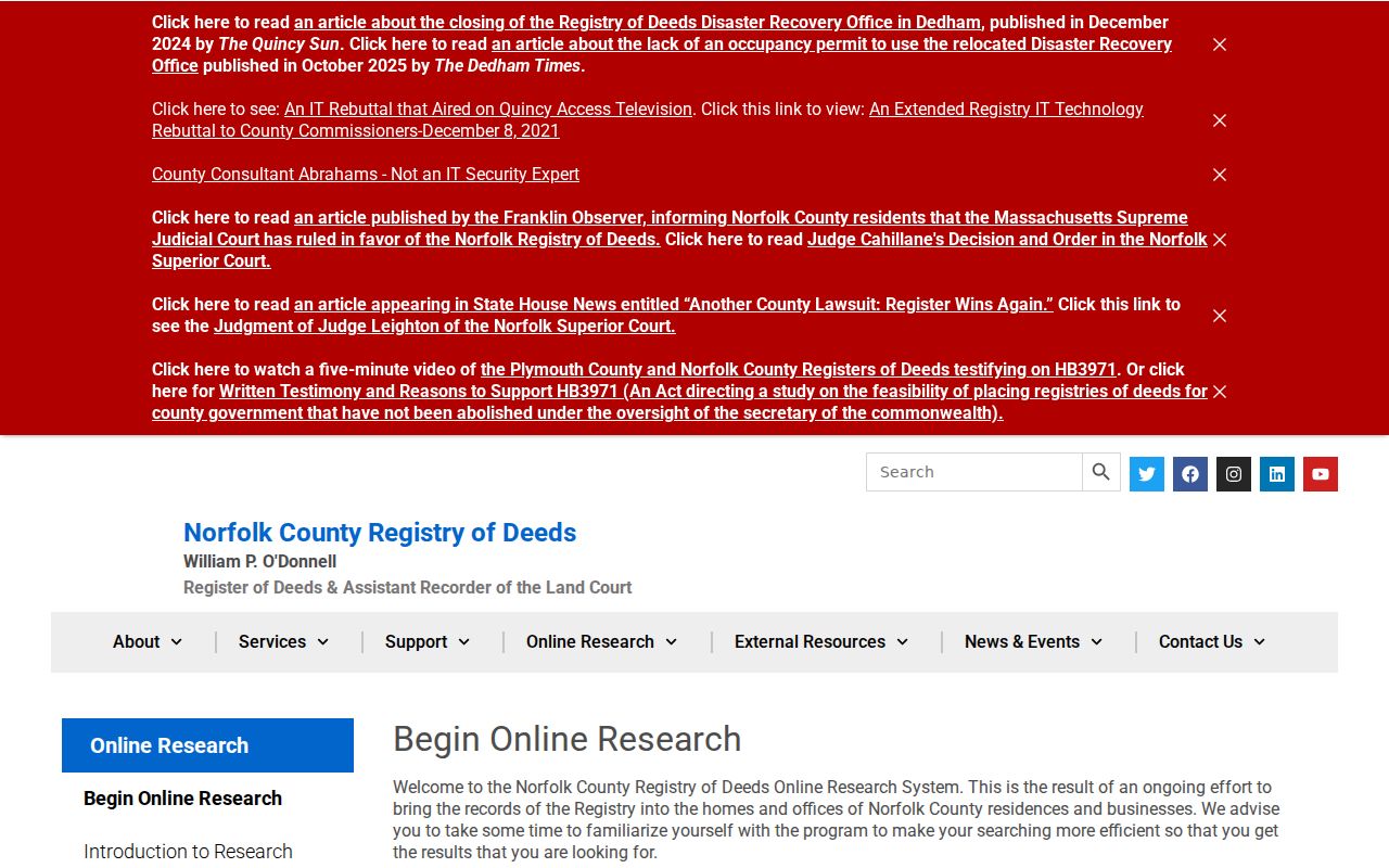
Norfolk County plans have complete index and image coverage according to Registry guidance, while a precise image or certificate may need the office's official-copy route. The Registry is at 649 High Street in Dedham, and research hours are listed as 8:30 a.m. to 4:30 p.m. Call ahead with the town, party names, approximate years, and any book, page, plan, or certificate reference.
Norfolk County Past Resident Households
For Norfolk County, previous residents are not always deed parties. Historical street sections and directories can supply an occupant or business association, while federal census material adds a household frame. The 1890 Wrentham and Norfolk volume has a dedicated Street Directory and a Resident Directory, and its locality abbreviations can turn a seemingly unfamiliar place into a useful historic address clue. The collection details and entry conventions are available through the Norfolk County directory book.
At a Norfolk County address, pair a directory year with the closest federal census year. The directory can provide a street, trade, business connection, or printed locality code. The census may supply ages, relationships, birthplaces, and an enumerator's geography. Differences can reflect the directory's publication date, a move, seasonal presence, or a boarder. Neither source proves title; each records a different historical role.
- Write the address as it appears in the historical source and note the town, village, or postal label.
- Check the relevant street or surname section, including initials and nearby streets.
- Match the nearest census by town and time period, then compare household composition without assuming identical boundaries.
- Test the result against a deed, plan, newspaper item, probate record, or house-history file before treating it as the same person.
Norfolk County Census Records and Maps
Dedham Museum identifies a Norfolk County Census collection covering 1790 to 1930, and its digitized collections include Sanborn maps. Library of Congress records list related Dedham editions for 1885, 1892, 1897, 1903, 1909, and 1917. A map can place a building, street, adjacent use, or physical footprint in time. It does not establish title or identify everyone who lived at the location.
For a Dedham address, the practical bridge is historical map or street label, MassGIS and municipal parcel context, then Registry plan and deed references. Elsewhere in Norfolk County, first verify the municipality because postal names and municipal boundaries can differ. Save the map sheet and date alongside the property record. A later parcel boundary should not be projected backward without a plan or recorded description.
No verified countywide chronology of street renumbering or renaming was located. When an old number will not map cleanly to the current street, use a town historical commission, assessor, planning office, Registry plan, directory, or historic map for the bridge. Record the source and date of that bridge instead of assuming that a modern address has always described the same place.
Norfolk County Previous Residents: Endpoints
Norfolk County probate, obituaries, cemetery records, newspapers, and municipal files can explain why a person leaves an address trail. A probate record may identify a fiduciary or property reference after death; an obituary can supply a date or family lead; a newspaper may connect a person to an event or local institution. These are connected evidence, not replacement deeds. Court and vital access rules differ, so ask the identified custodian what is public and what is restricted.
Norfolk County house and family history are appropriate reasons to trace a past address. Use the smallest amount of personal information needed to test a historical question, do not reconstruct protected records, and do not use an old address trail to track a living person. When a name, street, or town does not line up, preserve the conflict and seek a second source rather than forcing a match.
Lawful research. Use Norfolk County address history for family, property, and local-history questions, and never use records to stalk, harass, or harm anyone.